The college is seeking public input for their development plan for 3,000 acres of college land in the Champlain Valley in various Vermont towns including Middlebury, Cornwall and Weybridge, with smaller amounts in New Haven and Bristol. Throughout April, the college has hosted a series of four land planning and visioning sessions for members of the college community on April 9 and 11, in addition to sessions for the broader local and regional community on April 16 and 24.
The Lands Advisory Group — a collection of Middlebury faculty and staff who advise the administration and Board of Trustees on lands-related decisions — has shared an online survey to gather information about the community’s vision for future use of college-owned land.
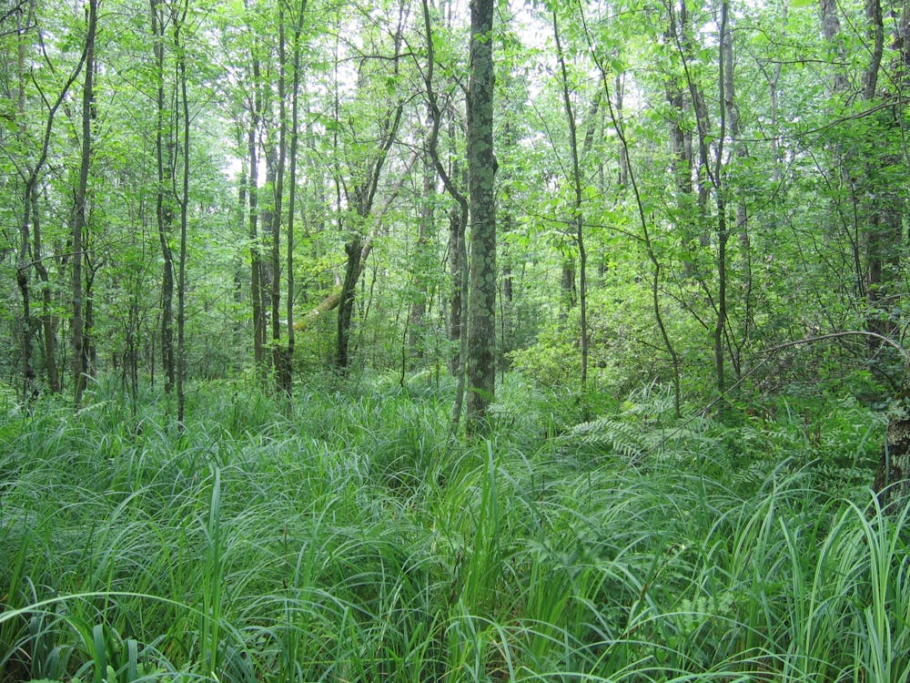
Middlebury holds approximately 6,000 acres of land in Vermont, including 2,100 acres of forest and field known as the Bread Loaf lands and 3,000 acres known as the Champlain Valley lands, according to Marc Lapin, associate laboratory professor and college lands conservationist.
Lapin is also the chair of the advisory committee, where he has played a critical role in the college’s land steward mission.
Though Middlebury has owned this land for decades, the college’s goals for land use have changed over time. “I think that society views land more broadly now than in the 70s and 80s,” Lapin said.
These sessions and the survey are attempts by the land advisory group to gather community insight firsthand. The group wants to collect information from individuals rather than relying on already-written mission statements and existing plans.
“We could go to documents and websites and pull things out from there, say ‘This is what society is thinking,’ but I would rather have people look at places on the map, tell their stories, envision the long term future, which is hard to get people to do,” Lapin said.
Historically, Middlebury has focused on maintaining agricultural land, developing the local economy and providing a scenic buffer. In recent years, the college has attempted to listen to more voices on land use and how to expand the resources these acres could provide the community.
“This is a really new way of the college interacting with the community, both the college community and the broader community in the region, regarding lands, and think about what will serve society’s needs and desires,” Lapin explained.
The Bread Loaf lands were put under a conservation easement in 2015, binding the land to be used only for the purpose of natural ecological values such as education and outdoor recreation, according to the Middlebury College Lands web page.
The college hopes to create a similar plan for the Champlain Valley lands to serve the community’s current needs and desires. It aims to design a 20–50 year-long plan that considers the values and visions of interest groups and individuals both at the college and in the local community.
The recent events are one part of the college’s efforts to engage community members in discourse about Middlebury’s land use by looking at maps to better understand the land. Lapin described one of his favorite moments of the student sessions as when six students stood around a map and discussed the land.
Maps help to see the land and determine whether certain plans are complementary or contradictory. Ultimately, the hard decisions come down to the limitations of what can coexist on the land.
One recurring theme across sessions was the common suggestion to use the land for recreation.
“In the listening sessions we’ve had… what I’ll call overemphasis on recreation. Which is, I think, because, in the college community particularly, some of us use this land for teaching and research, but most people interact with the land recreationally and visually,” Lapin explained
Lapin said the board has already discussed a recreation plan being built into the larger land plan. He added that these discussions have generated ideas about designs for safer road crossing — something that the college has previously been aware of, but can now further develop.
For the sessions including community members from the town of Middlebury and surrounding areas, the land advisory group invited leaders from local towns and representatives from interest groups to join the discussion. They called upon people from town governing bodies, local food systems communities, indigenous communities and land conservation communities.
Lapin said he enjoyed listening to different interest groups, including several groups advocating for Vermont towns to allocate land for BIPOC farming.
In order to gather these broader perspectives, the sessions for the college community were scheduled to be accessible to students and faculty during varying times of days and across multiple dates. Despite this, Lapin said that attendance for these sessions was still small.
“I would love for hundreds of people to look at the maps and provide input, think about it. I think it's a big part of being connected to land,” Lapin said. “Some people talk about the greatest disease of our time being disconnection from ourselves, others, earth. We’re offering opportunities to connect.”
Lily Buren ’26 completed the college land comprehensive plan survey, which included maps of different zones of land in the Champlain Valley and asked about the individuals’ values and vision for the plots.
“I wouldn’t be surprised if not a lot of people filled out the survey. The way they describe it, it would only be filled out by people who really care about the land, and can recognize the land on the maps,” Buren said.
Buren expressed a personal interest in the land owned by the college. After she looked at the maps, she was able to visualize where they were in relation to her everyday life and her engagement with the outdoors.
Buren shared her vision of what the land should be used for from one student’s perspective, such as allocating land closer to downtown Middlebury for community engagement and expanding community-based recreational activities in the Green Mountains and eastward. She also said she liked the idea of making trails more accessible to the public through updated infrastructure such as bus stops at more accessible sites.
The potential for education was also an important value that Buren associated with the college’s updated land use, suggesting that the land closer to the New York border could be used for research purposes.
“I know that as a biology student, we go to land around there and do some forest composition, data analysis and other types of labs that involve field work. I would love to see if that was expanded,” Buren said.
Although it is the Board of Trustees that gets the final say on the land planning, Lapin believes that the overall purpose of the land is to serve as an educational resource for the college.
Lapin described one participant at Tuesday’s meeting who advocated for all land to be used for educational purposes, an idea which he agrees is important when the college makes final decisions about land use.
“That’s what we do. We’re an educational institution,” Lapin said. “When crafting the plan, the community, the lands advisory Group and the Board of Trustees will ask themselves, “When it comes right down to it, are they serving the educational mission or not?’”


